La Valle- Sandy Point
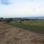
Over 400 Acres of prime land available.
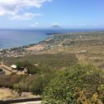
The parish itself is triangular in shape. The coastline of the parish is 4.06 miles (6.53 km) in length, with black sandy beaches, such as Pump Bay and Belle Tête dominating the southern coast, with sheer cliffs to the north. The lower slopes of the parish are dominated by abandoned sugarcane fields, as well as numerous small holdings, cultivating provision crops and tropical fruits. The town of Sandy Point, the second largest town on the island, skirts the southern coast, whilst the village Fig Tree rests just North of it. Moving inwards (East), the terrain shifts from the gently sloping coastal plain to the steep mountains of the North West Range, which, above 1000 feet, above sea level, is draped in tropical forests.
Land Area
- Parcel 1 : 331.99 acres
- Parcel 2 : 164.23 acres
TOTAL: 496.22 acres
La Vallee Sandy Point is the home of the world famous Brimstone Hill National Park Fortress, a UNESCO World Heritage Site popularly known as the Gibraltar of the West Indies.
It is a partially restored eighteenth-century fortress which saw active service during the colonial wars of the eighteenth and nineteenth centuries .


